Charting the Future of Methane Hydrate Research in the United States (2004)
Chapter: Color Plates
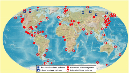
PLATE 1 Known and inferred gas hydrate accumulations and provinces around the world. Gas hydrate samples were recovered at known locations by research submersibles, remotely operated vehicles (ROVs), grabbing, dragging, piston coring, and coring during DSDP and ODP operations. The inferred locations are based on the presence of Bottom Simulating Reflector (BSR) and velocity amplitude peculiarities (VAMPs) on seismic records, well-log signatures typical of hydrate- bearing sediments, and freshening of porewater in sediment cores.
SOURCES: Data from Kvenvolden (1999) and Milkov and Sassen (2002), with additions by Alexei V. Milkov. Figure courtesy of Alexei V. Milkov, BP America, Exploration and Production Technology Group.
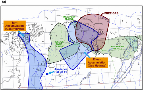
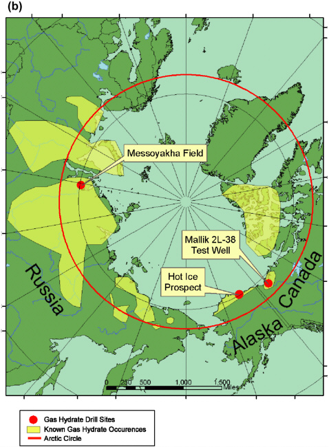
PLATE 2 (a) Distribution of the Eileen and Tarn gas hydrate accumulations in the area of the Prudhoe Bay and Kuparuk River oil fields on the North Slope of Alaska. Red dot shows location of the Anadarko Hot Ice No.1 drill site 2004. (b) Map of gas hydrate drill sites and gas hydrate occurrences in the Arctic Circle showing the location of the Mallik 2L-38 test well and other drill sites, 2002.
SOURCES: (a) Figure modified from Collett (2004); (b) Figure courtesy of Bill Liddell, Anadarko Petroleum Corporation, The Woodlands, Texas.
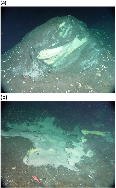
PLATE 3 (a) Bacterial mats and clams on an exposed hydrate sheet on the seafloor. (b) A thinly-sedimented mound of exposed hydrate and associated clam community on the seafloor. The mound is about 3 meters high and about 6 meters diameter. Both photos were taken in August of 2002, in Barkley Canyon, about 50 km offshore Vancouver Island in the northeast Pacific Ocean during a seafloor survey by ROPOS (Remotely Operated Platform for Ocean Science), a Canadian remotely operated vehicle.
SOURCE: Photos courtesy of Ross Chapman, University of Victoria.


