What does the butterfly effect have to do with weather forecasts?
Based on Science
Predicting the weather is hard because a small unknown in the observed weather today, for example in wind speed or humidity, can have big impacts on our ability to predict future weather. Forecasters must work with the challenging fact that even very slight differences in today’s weather may evolve to become large differences in future weather patterns. This is the “butterfly effect”, a term that came into popular use after a meteorologist used the metaphor to capture the complexity of predicting the weather. Fortunately, the influence of these changes on important weather patterns starts small and grows over time, so forecasts today are usually quite accurate up to several days in advance.
Last update May 25, 2022
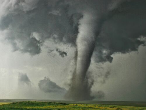
Campo, CO, tornado seen in sharp contrast with yellow wildflowers and clear skies
Predicting the weather is complex.
Weather is the state of the atmosphere at a given place and time. Accurately predicting the weather can help someone decide to carry an umbrella on a particular day, but more importantly, it can save lives and help people take action when extreme weather occurs. For example, forecasts can warn people to take shelter during a tornado, get out of the path of a hurricane, or stock up before a snowstorm.
People have been studying the weather for thousands of years. We’ve come a long way, but it is still hard to accurately predict the weather. This is because there are a lot of factors that affect weather—temperature, humidity, wind, and many others—and even a small change in one of these factors can have a large impact on future weather conditions.
In a scientific talk in 1972, mathematician and meteorologist Edward Lorenz captured this complexity with the question: Does the flap of a butterfly’s wings in Brazil set off a tornado in Texas? Lorenz left the question unanswered, but the idea of the “butterfly effect” draws attention to the fact that the outsized impact of small changes is part of what makes weather forecasting so hard. Since it is impossible to measure all of the factors that affect weather precisely or in real time, scientists must use estimates and probabilities to make predictions.
In simple terms, we can’t (yet!) observe every butterfly, so we don’t know all the tiny weather changes that are happening. Fortunately, the influence of these changes on important weather patterns starts small and grows over time. Thus, forecasts today are usually quite accurate up to several days in advance. But when forecasting seven days or more ahead, the butterfly effect becomes important and makes accurate forecasting increasingly difficult the further in the future you go.
Despite the challenges, the accuracy of weather forecasts continually improves.
The forecast for the next week’s weather is about as correct as a forecast for the next day’s weather was 50 years ago. This is possible because of tremendous advances in physics, data collection, and computing power. For example:
Doppler radars detect particles inside clouds to help meteorologists predict the path and severity of storms.
Weather observation stations, weather balloons, and commercial airliners collect detailed, real-time data on weather conditions at locations around the world.
Satellites allow us to monitor weather patterns at all locations across the entire globe.
Advances in atmospheric science have enabled development of computer models that increasingly capture even fine details of how weather evolves.
Powerful computers perform many calculations quickly to help interpret data and improve predictions.
Scientists use computer models to interpret current conditions and make weather forecasts. But no model provides the “right” answer. Running models with small differences over and over (called “ensemble” forecasting) helps reproduce the butterfly effect so forecasters can predict the range of possible outcomes. When many model runs tell a similar story, meteorologists know they can make predictions with more confidence. When different model runs show very different outcomes, the forecast is less certain.
Coupling social science research with more accurate forecasts will further reduce the loss of life from severe weather events.
Better forecasts save lives. Over the 20th century, the number of deaths from hurricanes and tornadoes in the United States had a significant downward trend. Today, forecasters are often able to predict dangerous conditions with enough notice for people to get out of harm’s way. It is unlikely that a hurricane today would cause the devastation of one that struck Galveston, Texas, in 1900. With limited ability to learn from offshore ships about the path of the hurricane and no high ground to retreat to, at least 8,000 people died when the 130+-mile-an-hour winds and accompanying storm surge struck the island. That hurricane remains the deadliest natural disaster ever to strike the United States.
Still, hazardous weather events continue to claim the lives of hundreds of Americans each year. To reap the benefits of weather forecasting, it is important not only to have accurate forecasts, but also for people to heed warnings and take appropriate action when bad weather is on the way. Today, a great deal of research is being done in the social and behavioral sciences to understand how people’s knowledge, experiences, perceptions, and attitudes shape their responses to weather risks. Integrating this research with weather forecasts will further reduce loss of life to extreme weather by ensuring forecasts are communicated in ways that result in communities heeding warnings and taking appropriate actions. There is also growing emphasis on helping individuals and communities reduce vulnerability and mitigate risks of hazardous weather well before an event strikes.