Investigation of Tools and Technology for Roadside Vegetation Asset Management (2025)
Chapter: Appendix B: Survey Questions
APPENDIX B: Survey Questions
Initial Survey
- Name
- Organization Name
- Title
- Email Address
- Phone Number
- What type of organization do you represent?
Transportation agency, Utility, Contractor
- May we reach out to you for a follow-up interview regarding your responses to this RLAM survey?
Yes, No
- Would your organization approve of being a case study for this project?
Yes, No, Not sure
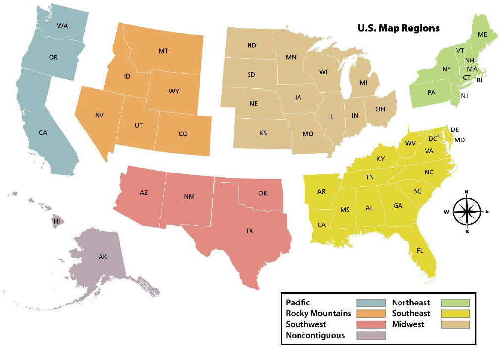
- In which region of the United States is your work completed?
Pacific, Rocky Mountains, Southwest, Noncontiguous, Northeast, Southeast, Midwest
- What percentage of LAM work is completed by in-house staff (not through agency partnerships or contracting)?
100, 90–99, 80–89, 70–79, 60–69, 50–59, 40–49, 30–39, 20–29, 10–19, 0–9, Not Sure
- What landscape assets do you track on a regular basis?
Trees or forest stands, Threatened or endangered species, Wetlands, Turfgrass, Remnant habitats, Mulched areas, Native vegetation, Pollinator habitats, Wildlife connectivity features, Weed presence, Vegetation safety features, Not sure, Other
- What landscape assets would your organization like to track that it does not currently?
Trees or forest stands, Threatened or endangered species, Wetlands, Turfgrass, Remnant habitats, Mulched areas, Native vegetation, Pollinator habitats, Wildlife connectivity features, Weed presence, Vegetation safety features, Not sure, Other
- What type of data tracking do you do?
Planning, Inventory, Condition rating, Mapping, Communication, Completed work, Litigation, Other
- What do you want your tools and technology to do that they cannot currently do?
Inventory vegetation, Track work progress, Planning, Assist with records for communication, Assist with records for litigation, Other
- Does your organization record and analyze any form of geographic data for management of roadside landscape assets?
Yes, No, It’s in progress, Not sure
- What is the state of your organization’s RLAM planning and data collection systems?
Early development, Mid development, Late development, Complete, Do not have one
- Have you implemented any new software or hardware within your organization (does not need to be new for the industry) in the last ten years to help manage landscape assets?
Yes, No, Not sure
- Is your organization currently piloting or testing new equipment for RLAM?
Yes, No, Not sure, Not applicable
- Please describe any new equipment for nonstructural asset management your organization is currently piloting or testing.
- Please indicate the degree to which you agree with the following statement (Likert Scale):
Our organization uses tools and technology to inform operations staff of how to manage the vegetation in the different ROW/corridor zones.
- What type of software or hardware does your organization use for RLAM? Include brand, if known.
Mapping software, Planning software, Remote-sensing software, Modeling software, Global navigation satellite system, 3-D laser software, Augmented reality (AR) software, Digital as-builts software, Intelligent compaction (IC) software, Thermal profiling, software, 5G/small cell software, Tablet, Computer, GPS unit, Cellular device, Unmanned aerial system, Other, Brand (if known)
- Please indicate the degree to which you agree with the following statement (Likert Scale):
Landscape management records are always supplemented with maps of managed areas.
- Please indicate the degree to which you agree with the following statement (Likert Scale):
Landscape asset information is always updated with each visit.
- Please indicate the degree to which you agree with the following statement (Likert Scale):
We are currently measuring what we need to with our current mapping procedures.
- When mapping landscape assets, is the process completed manually or through software/hardware?
Multiple Choice: Manually, Through software, Through hardware, Both, Not sure
- Are there any other thoughts or resources you would like to share with the committee?
Targeted Survey
- Name
- Organization Name
- Title
- Email Address
- Phone Number
- What type of organization do you represent?
Transportation agency, Utility, Contractor
- Would your organization approve of being a case study for this project?
Yes, No, Not sure
- When were your tools and technology (software or hardware used to gather or track information on landscape asset condition or to plan for future maintenance needs) last updated (years ago)?
Less than one, 1–2, 2–3, 3–5, 5–10, More than 10, Unknown, Have not been updated, Other
- What has prevented the purchase of tools and technology for use in landscape asset management?
Cost, Time, Staff training, Staff availability, Knowledge of management strategies, Not a priority, Not applicable, Other
- What has prevented the purchase of Tools and Technology for use in landscape asset management?
Cost, Time, Staff training, Staff availability, Knowledge of management strategies, IT security, Not a priority, Not applicable, Other (describe)
- What tools and technology have you implemented in the last ten years to help manage your RLAM program? Include brand if known.
New software, New hardware, Vegetation tracking, Vegetation mapping, Workflow management, Customer service organization, Measuring metrics, None, Other
- Please indicate the degree to which you agree with the following statements (Likert Scale):
The data and information obtained through tools and technology we’re using to manage our organization’s RLAM program has had a positive impact on:
Vegetation planning
Analytical tools
Maintenance operations logistics
Vegetation maintenance cycle
Response time for inquiries and complaints
Mapping
Data storage
Data tracking
Staff training
Staff hours
Operating budget
Interdepartmental communication
Assisting external communication
IT Questions
- Tools and technology do not always work properly. Does your organization use an internal or external IT department to provide support for mapping software or hardware issues?
Internal, External, Combination of the two, Not sure
- Have any difficulties occurred with obtaining assistance?
Yes, No, Not sure
- What issues occurred? Select all that apply.
IT rejected software upgrade, Delayed response time, Limited access for third party, Cost, Other
- Does your organization require parts of your system to be based in a domestic (US-based) location?
Yes, No, It’s preferred but not required, Not sure
- If yes, what part of the system needs to be domestically based?
Hardware manufacturer, Software manufacturer, Data storage, Other
- Does your organization use a cloud-based data storage solution?
Yes, No, Not yet, but we are open to the idea, Not sure
- For cloud-based solutions, what type of IT department is used to provide support to your staff?
Internal, Third party, Combination of the two, Not sure
- When mapping various aspects of the ROW corridor, what mapping vectors do you use most often?
Point, Line, Polygon
Landscape Architect
- Are environmentally sensitive areas to be recorded?
Yes, No, Not sure, Not applicable, Other
- If yes, how are these areas tracked?
Vector, Point, Paper mapping, Other
- How are these areas physically marked in the field?
Flagged, Fenced off, Signage, None, Other
- Please indicate the degree to which you agree with the following statement (Likert Scale):
Native species planting efforts are imperative to our RLAM.
Management
- Implementation of new tools and technology has impacted the financial return on investment to the department…
Positively, Somewhat positively, Neutral, Somewhat negatively, Negatively, Unknown, Not applicable
- Implementation of new tools and technology has impacted the number of hours spent on mowing and vegetation management by _______ hours.
Increasing, Somewhat increasing, Neutral, Somewhat reducing, Reducing, Unknown, Not applicable
Roadside Operations
- Please indicate the degree to which you agree with the following statement (Likert Scale):
RLAM is a primary goal for our ROW/corridor maintenance plan.
- Are ROWs/corridors digitally mapped with lines, points, or polygons?
Points, Lines, Polygons, No, Not sure, Other
- What landscape management practices are commonly used?
Mowing, String trimming, Herbicide to create bare ground, Herbicide to slow growth (PGR), Herbicide for invasive species removal, Brush mowing, Tree pruning, Tree removal, Other
- Please indicate the degree to which you agree with the following statement (Likert Scale):
Maintaining records of landscape management is a core component to our organization.
- Maps or maintenance records are uploaded to a server.
Internal local, Internal central, Third party, Not sure, Not applicable, Additional explanation
- How do you primarily limit growth near ROW corridors?
Plant growth regulator, Mowing, Pruning, Other
- Does your state have an invasive species law or rule?
Yes, No, Unsure
- Invasive vegetation species management is a top priority of our organization (Likert Scale).
Strongly agree to Strongly disagree, Unknown, Not applicable
- Our surveyors are trained on invasive vegetation species identification (Likert Scale).
Strongly agree to Strongly disagree, Unknown, Not applicable
- Limiting the spread of invasive pest species and diseases is a key aspect of our organization (Likert Scale).
Strongly agree to Strongly disagree, Unknown, Not applicable
- Our surveyors are trained on tree disease and pest identification (Likert Scale).
Strongly agree to Strongly disagree, Unknown, Not applicable
- Native plant management is important to our organization (Likert Scale).
Strongly agree to Strongly disagree, Unknown, Not applicable
- Our surveyors are trained to identify tree risk hazards (Likert Scale).
Strongly agree to Strongly disagree, Unknown, Not applicable
- Is equipment used for RLAM also utilized for other management or maintenance purposes (dual-purpose)?
Multiple choice: Yes, No, Unsure, Other
- If dual-purpose, what equipment is used for multiple tasks and which tasks are they?
- Has your organization purchased tools and technology to help with RLAM?
Yes or No
- Are there any other thoughts or resources you would like to share with the committee?


