Transforming Transportation: Leveraging the Power of Artificial Intelligence, Digitalization, and Automation (2026)
Chapter: The Power and Promise of Digitalization
The Power and Promise of Digitalization
The digitalization of transportation infrastructure and operations continues to offer new possibilities to enhance transportation efficiency, mobility, and safety. Digitalization leverages digital tools to transform business, management, and operations activities. The following section outlines technologies and innovations that are expanding the benefits from transportation digitalization.
Infrastructure Modeling, and Digital Delivery and Asset Management
Digital data that describe transportation infrastructure and operations combined with advanced software and modeling programs can contribute to optimizing asset management, accelerating project delivery, and streamlining infrastructure projects. To take full advantage of digitalization’s promise also requires integrating data from diverse sources across multiple platforms. Transportation agencies generate massive amounts of data throughout the life cycle of assets, but much of it resides in disconnected systems and silos, making it difficult to share information.
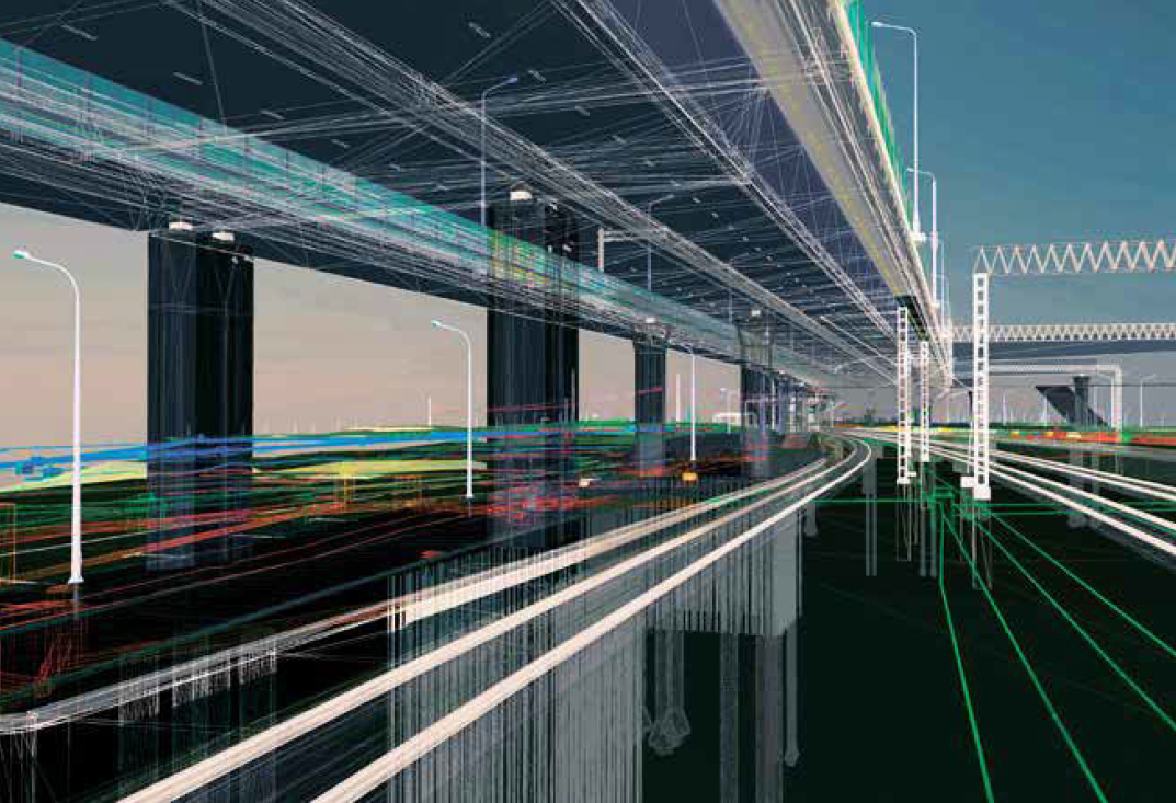
For infrastructure projects and assets, digital tools can produce digital outputs for planning and decision making and create online portfolios that cover the life cycle of an asset. For example, infrastructure modeling and digital delivery bring together the physical and digital components of a construction project and can be used to improve
design and planning, optimize resources, and accelerate project delivery.49 A key component of infrastructure modeling includes the 3D and digital twin modeling of transportation assets, such as bridges, tunnels, and ports. These models act as dynamic digital replicas of physical infrastructure, which can be used to test real-world scenarios, enable real-time monitoring and predictive analytics, and optimize the system before changes are implemented on the physical system. 3D models and digital twins may include real-time incident detection and notification for drivers and first responders; integrated sensors on bridges and roadways for synchronization and dynamic signaling; and simulations of incidents, extreme weather, and traffic.50 For example, a pilot project in Washington State integrates active sensors on real bridges and roads with digital twins to monitor conditions and detect safety concerns for informed maintenance and decision making.51
In coordination with infrastructure modeling, Business Information Modeling (BIM) is a digital process that enables people to create and manage digital 3D models of infrastructure projects throughout their life cycle, from the design and bidding process to post-construction as-builts. BIM is a collaborative method for managing an agency’s data across an asset’s life cycle—freeing data from siloed systems and integrating the data into semantically rich 3D models and digital workflows. By moving from paper-based plans to connected digital models, agencies can improve project delivery, reduce errors, and make more data-driven decisions.
Case studies of BIM use show it can decrease costs and time spent by reducing the number of change orders throughout a project, enhancing project delivery, and enabling the use of automation. Digital delivery projects use a similar approach, where all aspects of a project life cycle are conducted through modeling software, digital twins, asset management databases, and other digital tools. Pilot projects across states intend to use digital delivery systems to reduce error and risk in project management, increase accuracy of models and designs, allow for the digital transfer of data from design to construction, enable more precise and competitive design bids, and improve decision making.52,53 Indeed, some state DOTs have advertised construction projects for which 3D models, rather than paper plans, represent the controlling legal document. States anticipate that digital delivery should reduce the number of change orders during construction and the overall project risk, improve communication across partners, improve safety on construction sites, and reduce construction costs.54 For example, Pennsylvania DOT is conducting a series of digital delivery pilot projects focused around 3D modeling and detailing tools for bridges and highway projects, design development and delivery processes, and project analysis.55
Iowa DOT implemented BIMs and digital models that represent as-built infrastructure conditions, known as digital as-builts, to improve asset management and enhance project delivery throughout their I-80/I-380 Interchange Reconstruction Project.56 The project utilized a collection of technologies to collect and manage data, including geospatial data, design and modeling, e-ticketing and document management tools, web interfaces to visualize data, and asset management systems to allocate resources. Iowa DOT found that the digital model could be continuously updated during construction, allowing for real-time project data, modeling, and analysis. At the same time, Iowa DOT noted that there are still challenges in integrating these new technologies, including the large investments needed for training and development and the lack of standardization across software, protocols, and
data types. In this regard, it merits noting that the American Association of State Highway and Transportation Officials (AASHTO) has endorsed the use of an open, international standard (ISO 16739) for sharing BIM data across different software applications and ensuring vendor-neutral interoperability. In addition, the Federal Highway Administration (FHWA) worked with state DOTs and industry to develop the BIM for the Infrastructure National Strategic Roadmap.57
Digital Infrastructure: Sensors, Imaging, Hardware, and High-Speed Computing and Communications
In its fullest form, digital infrastructure combines sensing, imaging, hardware, processing, and communication systems to enable continuous data transmission and information exchange between data systems, users, public agencies, and operators. Advances in computing, sensing, and communications technologies enable monitoring and collection of real-time data about the transportation system while geolocation systems determine location for mapping and navigation and communication systems facilitate data exchange between and across systems.
Sensors installed along transportation corridors, including roadways and railroads or within vehicles, collect the data needed for digital infrastructure. Sensing and imaging technologies include speed detection, video-based systems, light detection and ranging (lidar), radio detecting and ranging (radar), motion detectors, and more. Within roadway infrastructure, these devices can detect accident hazards, weather and road conditions, lanes and medians, and the presence of vehicles, pedestrians, and bicyclists. Similarly, sensors are used in other modes for detecting hazards, monitoring weather, preventing collisions, and tracking vehicles or passengers. For example, prototypes are in development that combine sensors and AI to lower the cost of rail track inspections.58 While many sensing technologies have been established for decades, the combination of sensors with advanced computing, geolocation, and communication technologies have advanced innovations across transportation.
DIGITAL INFRASTRUCTURE FOR ROAD SAFETY AND TRAFFIC MANAGEMENT
Roadway digital infrastructure utilizes sensors, imaging, hardware, and communication technologies to manage travel and safety, including for the safety of road users and highway workers. Although many other potential applications exist, the following paragraphs highlight a few examples of key roadway innovations already being piloted and implemented across the country, including for traffic management, pedestrian safety, and safer construction zones.
In high-traffic cities and transportation centers, digital infrastructure systems can detect and respond to vehicle and pedestrian patterns across a network to actively manage traffic, optimize the movement of vehicles, improve safety for roadway users, and reduce congestion. For example, the city of Bellevue, Washington, piloted passive pedestrian detection technology to increase safety at intersections. The system uses lidar to map objects across an intersection, AI-powered software to detect pedestrians and vehicles, and feedback into the city’s adaptive signal control system to alter the timing of stoplights and pedestrian signals.59,60 Similarly, adaptive signal control technology (ASCT) uses sensors to detect vehicles, assess
performance, and automatically adjust signal timing based on real-time roadway conditions. Pilot studies in Arizona and Florida found that ASCT systems significantly reduced traffic delays and decreased overall travel time for drivers.61,62 In addition, advances in data extraction may make it possible to leverage existing traffic sensing technologies to produce traffic volume data for motorized and non-motorized traffic in real time and on a continuous basis, which could be used to improve signal timing and traffic flow as well as other applications in traffic safety, planning, and statistics.63
In 2024, Utah DOT, Colorado DOT, and Wyoming DOT partnered with transit authorities, local cities, and the private sector to establish the Connecting the West program, which focuses on communications and sensing technologies for roadways.64 One project focuses on Traveler Information Messaging, which uses data from roadside detectors and connected vehicles65 to alert drivers about road conditions, weather changes, lane closures, and work zones. The Transit Signal Priority program provided wireless communication between Utah Transit Authority buses and traffic signals along key corridors, allowing drivers to request additional green light time to maintain the bus schedule. Other projects are exploring lidar and connected vehicles to improve efficiency, safety, and connectivity. The Connecting the West program plans to increase deployment across all three states, with aims to improve interoperability and connectedness across state lines.
Vehicle telematics is the collection and transmission of in-vehicle data, such as vehicle speed, location, turning movements, and condition, as well as driver phone use or other distracted behavior. Commonly used in fleet management and driver insurance, advances in vehicle telematics that can collect, communicate, analyze, and anonymize these data in real time could be used for a variety of safety and operations applications.66 For instance, New York City (NYC) DOT is piloting using vehicle telematics collected from commercial vehicles to track speed, travel time, and vehicle class on specific streets and roadway segments. NYC DOT intends to use this information to identify problem zones for speeding and congestion and to inform traffic interventions that improve safety and mobility, such as reduced speed limits, optimized infrastructure design, and signal timing.67
Faced with new and growing demands on curb space, the Boston Department of Public Works is using AI and lidar technology to read and process street-level imagery for converting parking layout and regulations into a digital format.68 The information will be used to create an interactive map of the city’s curb network to provide motorists with access to real-time information on parking inventory and street sign rules. The interactive map is expected to add convenience for travelers and limit the congestion caused by vehicles circling and blocking lanes in search of parking.
DIGITAL INFRASTRUCTURE FOR IMPROVED SECURITY
Across all modes of transportation, digital infrastructure can bolster security, surveillance, and communications. In aviation and rail, surveillance cameras and AI-powered detection systems can identify and report security threats. For example, airports in Charleston, South Carolina, Los Angeles, California, Columbus, Ohio, and Charleston, West Virginia are implementing shooter detection systems that use acoustic and infrared sensors, cameras, and AI-based video analytics to detect gunshots and track suspects.69,70 Detection systems along railroads use a similar combination of AI-based detection systems and
sensors, including video sensing, infrared, radar, lidar, and fiber technologies, to detect trespassers in restricted areas, announce pre-recorded warnings, and send alerts to personnel and law enforcement.71 Within maritime environments, sensing technologies are being studied for surveillance and data collection for tactical surveillance and undersea missions, including autonomous sensors and intelligent sensor systems.72


