Cooperating with Nature: Confronting Natural Hazards with Land-Use Planning for Sustainable Communities (1998)
Chapter: Part Two: The Land Use Planning Alternative4 Integrating Hazard Mitigation and Local Land Use Planning
CHAPTER FOUR
Integrating Hazard Mitigation And Local Land Use Planning
DAVID R. GODSCHALK, EDWARD J. KAISER, AND PHILIP R. BERKE
HAZARD MITIGATION AND LAND use planning share a future orientation. They are concerned with anticipating tomorrow's needs, rather than responding to yesterday's problems. Both are proactive rather than reactive. Both seek to gear immediate actions to longer-term goals and objectives. Together they can be powerful tools for reducing the costs of disasters and increasing the sustainability of communities.
This chapter examines the role of local land use planning in mitigating the threats posed by natural hazards. While we acknowledge the importance of federal and state planning and mitigation policies, we take a "bottom-up" local view of the intergovernmental system for hazard mitigation rather than a "top-down" state and federal view. We explore local land use planning's basic powers and authority; the creative process of integrating land use planning with mitigation; the critical choices to be made among levels of stakeholder participation, plan components, plan types, and mitigation strategies; and principles for crafting high-quality mitigation plans.
Integrating hazard mitigation and local land use planning is not a new idea. Hazard specialists have
long argued that it makes sense to prevent development in hazardous areas, to design structures to withstand stresses imposed by hazards, and to build public facilities, such as roads and bridges, to stand up under hazard forces while allowing for evacuation of threatened populations (Baker and McPhee, 1975; Berke and Beatley, 1992b; Burby and French et al., 1985; Godschalk et al., 1989; and White, 1945). However, the general public and locally elected officials tend to minimize the importance of discouraging development in hazardous areas. In fact, localities sometimes adopt public policies that unwittingly encourage such development.
What is new about our approach is its linkage of land use planning and hazard mitigation with each other and with sustainable communities—where people and property are kept out of the way of natural hazards, where the inherently mitigating qualities of natural environmental systems are maintained, and where development is designed to be resilient in the face of natural forces (as discussed in more detail in Chapter 8 , and in Berke, 1995, and Munasinghe and Clarke, 1995). We believe that the time is ripe for such an approach, given the current awareness of the unsustainability of contemporary land use and urban development practices. In the United States, the staggering costs to taxpayers of recent natural disasters such as Hurricane Andrew ($1.64 billion) and the Northridge earthquake ($3.32 billion) have increased public awareness of the need to act beforehand if urban areas are to protect themselves against future disaster threats. To do this successfully requires an understanding of the way in which the values underlying the concept of sustainability can be integrated into the practice of local land use and hazard mitigation planning.
In the pre-disaster period, sustainability values seek to avoid saddling future generations with sprawling, wasteful land use patterns that not only reduce the social livability and economic viability of communities, but also undermine the ability of the natural environment to absorb hazard forces and expose people to significant hazard risks. In the post-disaster period, sustainability values seek opportunities to relocate land use out of hazard areas and rebuild damaged homes and infrastructure in more resilient ways instead of replicating brittle and unsustainable development practices.
PLANNING FOR SUSTAINABILITY
Mitigation planning combines technical analysis and community participation to enable communities to choose wisely between alternative
strategies for managing change, and thereby to achieve long-term community sustainability. To that end, the planning program is intended to produce a plan for avoiding or mitigating harm from natural disasters, and for recovering from disasters. The plan details strategies for implementing policies, regulations, capital improvements, and taxing and pricing mechanisms that recognize the economic and equity aspects of sustainability. The planning process also generates valuable information about long-term threats posed by natural hazards to the safety and viability of human development and environmental resources; and it assists with problem-solving before, during, and after disasters.
Planning Applied to Mitigation: In Concept
A mitigation plan is a statement of intent. It states aspirations, principles of action, and often specific courses of action the community intends to follow to achieve those aspirations. It is formulated through a systematic process involving a broad representation of community citizens, stakeholders, and officials, and it commits the community to a course of action designed to accomplish considered goals—to reduce losses to private property or to reduce vulnerability of lifeline facilities. Making a plan serves several purposes, some obvious and some not so obvious.
First, the planning process gives a community the opportunity to consider community issues in a systematic and comprehensive manner. It is a practical way to raise, study, and debate issues, and to articulate community goals. In the initial stages, the planning process requires much input of information, such as data on hazards, their geographic variation, and the degree of threat they pose (see Chapter 5).
Second, the process demonstrates the connection, the rational nexus, between public interests and proposed policies or programs. For example, the plan can document the likelihood of property damage if development is permitted in high-hazard areas. In other words, the planning process provides a rational basis for action that is necessary for both political and legal defensibility.
Third, in the course of generating the information necessary to making decisions, the planning process educates the community, and particularly those with a stake in the outcome of the process, about natural hazards and what is feasible to do about them.
Fourth, after acquiring and assimilating information and debating the issues, the planning process allows participants to reach a consensus
on goals and actions, to resolve conflicts over priorities and methods, and to build commitment to elements of the plan.
Fifth, a long-range and comprehensive plan coordinates the multiple issues, goals, and policies of a community. For example, hazard mitigation goals, policies, and programs can be integrated with other community goals, policies, and programs for economic development, environmental quality, community development, housing, and infrastructure programming. This avoids uncoordinated and possibly conflicting policies and actions.
Sixth, the plan documents a community's goals, policies, and programs and communicates them to citizens and interested stakeholders, from developers and property owners to elected officials. For example, a plan can ensure widespread understanding of the way that future development will be directed away from high-hazard areas, such as floodplains. The plan alerts everyone to the community's commitment.
Finally, the plan is a means of implementing policy. It is a reference for elected and appointed officials to use in reaching decisions when considering ordinances, allocating money for capital improvements, or granting permits for new developments. It encourages private developers to follow the adopted hazard mitigation policy in order to expedite their permit applications. It is a guide toward coordinating the community's actions along consistent lines.
The Values Supporting the Concept of Sustainability
Land use planning must deal with three powerful sets of community values associated with land (Kaiser et al., 1995). Social values refer to the weight that people give to land use arrangements as the cultural settings for living their daily lives. Market or economic values express the weight that people give to land as a real estate commodity. Ecological values express the weight that people give to maintaining natural plant and animal communities on the land.
These sets of values also underlie the concept of sustainable communities (Clarke and Munasinghe, 1995). One social value that is fundamental to the idea of sustainability is the value it places on participation of at-risk communities in planning to reduce vulnerability. Sometimes those most at risk are the poor, the group most likely to live in hazard areas because they cannot afford better, safer land. To increase awareness of hazards and opportunities for mitigation, planners must commu-
nicate and consult with those at risk. This may entail decentralizing some decision making to give neighborhoods more control over the choice of mitigation strategies and to promote responsibility among individuals and organizations.
The basic economic value underlying sustainable communities is the desire to preserve and enhance a community's capital assets. These include both natural and man-made capital, which complement each other and increase the community's capability to remain viable in the face of shocks. Cost-effective methods of preventing environmental catastrophes also prevent or reduce losses to productivity that constrain economic growth. Economic resources should support the present population without decreasing the economic opportunities of future generations, that is, they should be characterized by intergenerational equity.
Finally, sustainable communities stress the ecological value of preserving the resilience of biological and physical systems and their ability to adapt to change. This involves limiting environmental degradation from pollution and uncontrolled urban development, as well as maintaining those natural systems, such as wetlands and dunes, that increase a community's ability to absorb external shocks from natural hazards. It involves maintaining biodiversity, which enhances the adaptive capacity of natural systems. The connection between degradation of natural resources and vulnerability to natural catastrophe demands preventive planning.
A Model Linking Land Use Planning, Mitigation, and Sustainability
One way to visualize the linkages between land use planning, mitigation, and sustainability is to think of them as parts of a three-legged stool, as shown in Figure 4-1. The seat of the stool represents mitigation/land use planning. The three legs of the stool are social values, market values, and ecological values. Each of these must be balanced to support long-term sustainability, the ultimate goal of the process. A community mitigation/land use planning effort cannot tilt its goals in only one direction without endangering the balance and viability of the community's survival. The three-legged stool metaphor illustrates the dependence of the planning program upon a clearly stated and balanced set of social, market, and ecological values. (See Kaiser et al., 1995, Chapter 2, for a more detailed discussion of this metaphor.)

FIGURE 4-1 Community values, mitigation/land use planning, and sustainability.
Source: Kaiser et al., 1995.
UNLEASHING THE POWER OF LOCAL LAND USE PLANNING
Local actions can have a powerful impact on losses due to natural disasters; for example, actions taken after the 1993 floods in Missouri reduced the damages from the floods that followed in 1995. Arnold, Missouri, acquired 85 residential structures, 2 commercial structures, and 143 mobile home pads in a buyout program following the 1993 floods (Kaiser and Goebel, 1996). Local officials stated that the impact of the buyout was tremendous. When the fourth largest flood in the city's history struck in 1995, most of the flooded areas had already been purchased, and those residents did not face evacuation and the need for disaster relief.
According to the 1995 FEMA national mitigation strategy, ''all mitigation is local." While mitigation against hazards ultimately requires local action, it is important to acknowledge that local action typically occurs in an intergovernmental framework of federal and state policies and programs aimed at empowering and motivating local governments to build mitigation into their plans and actions. In the Arnold, Missouri, example, the funds for the local buyout came from federal disaster assistance and community development programs.
As discussed in Chapter 3, authority, requirements, and incentives for planning and mitigation come down to local governments from the top of the intergovernmental framework. The federal government, under the Stafford Act and other laws and programs, supplies disaster mitigation funding, policy and program guidance, and technical assistance to states and localities. State governments, under their constitutional powers, enact laws transferring authority to local governments for planning and regulating land use, building design, and environmental protection. Local governments make use of these programs, assistance funds, and laws when formulating hazard mitigation plans.
In hazard mitigation, as in other areas, the powers of local governments vary according to their goals and methods:
Planning power—To gain community agreement on a land use plan, local governments can educate, persuade, coordinate, encourage participation and consensus, and offer a vision of the future.
Regulatory power—To direct and manage community development in order to achieve desirable land use patterns and mitigate natural hazards, local governments can use tools of zoning, subdivision regulations, building codes, sanitation codes, design standards, urban growth boundaries, wetland and floodplain regulations, and the like.
Spending power—To control public expenditures to achieve community objectives such as concurrency of infrastructure provision with growth or restricting provision of infrastructure within hazard areas, local governments can use capital improvement programs and budgets.
Taxing power—To support community programs such as infrastructure building and hazard mitigation, local governments can use such tools as special taxing districts and preferential assessment for agriculture and open-space uses.
Acquisition power—To gain public control over lands such as hazard areas, local governments can make use of the right of eminent domain, can purchase development rights, and can accept dedication of conservation easements.
Thus, local governments have considerable power to plan and regulate land use and development. (See Chapter 6 for further discussion of the applications of this power.) But while there are impressive examples of integrating mitigation into local land use practices, overall the level of
local response to hazards has been limited. [Berke and Beatley (1992b), Burby and French et al. (1985), and Godschalk et al. (1989) describe local land use practices that have been developed to reduce losses from earthquakes, floods, and hurricanes, respectively.] The lack of effective mitigation programs is not surprising given such obstacles as minimal public interest in natural hazards and the difficulty of operating programs in an intergovernmental setting.
May and Williams (1986) characterize the difficulties of implementing disaster policy under shared governance as a basic dilemma for hazard mitigation. On one hand, federal and state officials have an important stake in promoting hazard mitigation given the escalating disaster reconstruction costs they face (Burby et al., 1991). On the other hand, local governments and property owners in hazard areas are reluctant partners in implementing shared government risk reduction programs, given the lack of a constituency for hazard mitigation.
One way to resolve this policy implementation dilemma is to include mitigation planning in the more commonly used land use planning process, and to design hazard mitigation strategies that also achieve other community goals, such as protection of natural resources and provision of recreation areas and open spaces. The objective of this chapter is to lay out such an integrated approach.
BUILDING HAZARD MITIGATION INTO LAND USE PLANNING
In many communities, hazard mitigation plans are prepared by emergency management staff members and are not tied to comprehensive plans. The products are separate, stand-alone hazard mitigation plans. Later in this chapter, we discuss stand-alone mitigation plans and the choices they involve in more detail. First, however, we describe an integrated approach that fits hazard mitigation into a more comprehensive community land use planning context. When possible, such an integrated approach is preferable to stand-alone mitigation planning.
Context and timing are important factors distinguishing stand-alone mitigation planning from mitigation planning that is integrated with comprehensive planning. Stand-alone mitigation plans may be prepared when communities have not previously adopted comprehensive plans or their comprehensive plans are hopelessly out of date. Often, though not always, stand-alone mitigation plans are prepared in the aftermath of a recent disaster. Thus, they tend to focus on averting a future disaster like
the one just experienced by the community. The sense of crisis leads to a call for immediate action. Sometimes called the "window of opportunity," this post-disaster period can break down resistance to mitigation and encourage innovative policy proposals. However, the pitfalls of such planning include the assumption that the next disaster will be a clone of the last disaster ("fighting the last war"), the tendency to make quick plans without a sufficient hazard information database, and the failure to integrate mitigation plans with other related community plans, such as land use and infrastructure. These pitfalls can be overcome by building mitigation planning into continuing community land use planning.
Land use planning is an ongoing process. (For an overview of this process, see Kaiser et al., 1995.) Plans are usually prepared, implemented, and revised on a five- to ten-year cycle. A community planning board made up of citizens works with the professionals on the planning staff to prepare the draft plans, guide them through a public participation process, and craft their final recommendations to the elected officials who make the ultimate decisions about content, and then adopt the plans. The plans produced incorporate both objective technical information and analyses, and more subjective value perspectives and stakeholder preferences. Hazard mitigation may be one goal of a land use plan, along with other community goals such as coordinating future growth with infrastructure capacity or protecting fragile natural resources. (See Federal Emergency Management Agency, 1996, for an overview of the floodplain management planning process.)
The purpose of the planning process is to generate the needed information and specify the goals, policies, and evaluation criteria of a mitigation/land use program that can ensure sustainable communities where people and property are protected from natural disasters. Steps in the planning process include:
Generating planning intelligence, which defines the problem and serves as the factual basis of the plan. It usually consists of information on local land use patterns and on community vulnerability to hazards by type, location, and intensity (a hazard assessment); and an assessment of the feasibility and effectiveness of possible solutions (a capability analysis). While intelligence collection and interpretation primarily involve technical activities, disseminating information to the community through a public awareness and education program is essential to building the understanding of, and incentive for, a collaborative mitigation/land use implementation strategy.
Setting goals and objectives, which describe the plan's benchmarks for achievement derived from the citizen participation process (e.g., targets for reduction in vulnerability; increases in residential land needed to accommodate long-range projected population increases while meeting environmental quality standards). In practice, planners draft the initial goals and objectives statements, but these are modified through various public involvement techniques, such as visioning (Nelessen, 1994), goal setting, and consensus building (Godschalk et al., 1994; Innes, 1992).
Adopting policies and programs, which lay out the actions required to achieve the plan's objectives (e.g., establishment of a land acquisition program for threatened property in the hazard area; creation of a conservation easement program to protect farmland). Planners analyze alternative policies and programs in terms of anticipated effectiveness, efficiency, equity, and feasibility in achieving the selected goals and objectives. Citizens and stakeholders debate the desirability of various policies and programs from the standpoint of their values and engage in conflict resolution processes, such as facilitation and mediation, as necessary to reach agreement on disputed proposals.
Monitoring, evaluation, and revision, which seek to adapt the plan to community change (e.g., assessing the effectiveness of a program to acquire land in hazard areas against the plan's objectives and other possible mitigation strategies in light of recent disaster experience; measuring the impacts of a cluster development ordinance on stormwater run-off). Planners track the progress of implementation and evaluate its success through ongoing impact analyses. Citizens and stakeholders take part in evaluation procedures, both at the specified five- to ten-year intervals for formal revision of the plan, and when an event such as a disaster or a major change in the community's economic base necessitates a revision. Consensus building comes into play again when necessary to gain agreement on desired modifications to the plan.
Some see community involvement as a separate activity, done at the beginning or end, and segregated from the other technical and decision-making steps in the planning process. We see it as a parallel, integrated, and continuous part of the planning process. Table 4-1 illustrates the parallel technical and community involvement activities in formulating, debating, and approving plan components during an integrated mitigation/land use planning process.
TABLE 4-1 An Integrated Mitigation/Land Use Planning Process
Planning Step | Technical Activities | Community Involvement |
Intelligence | Land use projections Hazard assessment Capability analysis | Awareness program Information dissemination |
Goals/objectives | Vulnerability reduction Environmental quality Population accommodation | Visioning/goal setting Consensus building |
Policies/programs | Hazard avoidance Risk reduction Growth management | Policy debate Conflict resolution Plan adoption |
Monitoring/evaluation | Plan/program performance Mitigation effectiveness Impact measurement | Plan evaluation/revision Agreement on modifications |
DESIGNING A PLANNING APPROACH: FOUR AREAS OF CHOICE
There is no single model for designing a hazard mitigation planning approach that ties together the necessary technical and community involvement activities. Instead, the planner and the community must choose among alternatives in four areas. They must choose what methods to employ to involve the community in the planning process; which components of a plan to include and emphasize; what type of plan is most appropriate for the specific situation; and perhaps most importantly, what mitigation strategy to employ. Because of the number of possible alternatives, this is a process of thoughtfully selecting and adapting the alternatives that best serve community needs rather than mechanically following a recipe in a planning cookbook. The combination of choices from among alternatives within each of these four areas comprises the mitigation planning approach. This is a custom-designed planning approach in that choices are mixed and matched, and adapted. The variations in approaches are rich and still evolving in practice, as they should be.
In this section we describe alternatives available for each of the four dimensions—stakeholder participation process, plan components, plan type, and mitigation strategy—and illustrate them from contemporary mitigation planning practice and writing.
Choice One: The Approach to Stakeholder Participation
Enlisting community help and support in formulating a hazard mitigation plan and seeing mitigation measures adopted is the essential first step in planning. Local elected officials are unlikely to vote for mitigation measures that are either highly controversial or about which no one seems to care. Thus, to build public involvement it is first necessary to promote awareness by disseminating the findings of a local hazards analysis to the community at large, as well as to specific groups and individuals affected by hazards and mitigation proposals. The awareness efforts can include media campaigns, public school information kits, homeowner and builder/developer seminars, community organization speaker series, and similar public information approaches aimed at informing and motivating the community to address natural hazards.
Once public awareness of natural hazards has grown, a more collaborative involvement of the community is needed to set mitigation goals and objectives. This process combines technical planning activities such as preparing alternative goal statements, public participation activities such as taking part in community visioning or goal setting, and political activities such as building consensus among stakeholders and elected officials over adopted statements of goals and objectives. Choices regarding goal and objective setting include both who to involve and how to involve them. Participants can be viewed in terms of their influence and their interest in mitigation. Figure 4-2 illustrates this concept, with decision makers and direct stakeholders at the center, surrounded by layers of community organization leaders, watchdog group leaders, and finally the general public. The most intense involvement takes place closer to the center.
A number of participation models are available (see "Designing a Mutually Acceptable Process" in Godschalk et al., 1994). The most common one consists of a central planning committee with several task groups or subcommittees, organized by geographic hazard area or by mitigation strategy, such as buyout, for example. Another possibility is a large open community mitigation planning conference followed by smaller task groups that report back to the conference. A third possibility is a planning committee or board, either already existing or set up specifically for mitigation, which invites public participation and comment through public hearings and forums. If mitigation is highly controversial, mitigation planning may be accomplished through a dispute reso-

FIGURE 4-2 Levels of participation in mitigation planning.
Adapted from Godschalk et al., 1994, Figure 9.
lution process, perhaps involving a facilitator or mediator. The exact form of participation is probably less important than ensuring that all affected stakeholder groups have an opportunity for genuine involvement in the process and are satisfied with its fairness.
Once there is agreement on goals and objectives, the community can select its implementation policies and programs. Typically, this is a continuation of the previous process, using the same stakeholders and participation techniques. However, it also is likely to be more contentious, as individual stakeholders debate the merits of policies that have a direct effect on their values. And it may involve more direct attention from elected officials who will be called upon to act on the final implementation agenda by adopting new regulations or approving new public expenditures. Thus, this stage may well call for negotiation among the stakeholders, with the use of dispute resolution techniques, such as facilitation and mediation by neutral third parties, to enhance agreements on adopted plans. This step concludes with the official adoption of the final plan.
Over time, it is necessary to monitor and evaluate the adopted plans to determine their effectiveness in meeting community goals for mitigation. During this step, which may take place on a regular schedule (such as every five years in the case of a land use plan) or on an as-needed schedule (such as following a major disaster), the adopted plan is scrutinized and revised. Public participation here can involve reconvening the groups that took part in preparing the plan to review staff analyses, evaluation reports, and potential revisions. Again, a consensus-building effort may be required, particularly if the adopted plan contains clear weaknesses and the evaluation calls for more rigorous mitigation actions that more directly affect important stakeholders.
Choice Two: The Emphasis Within Each Plan Component
As discussed earlier in this chapter, we suggested that the more or less essential parts of a plan are an intelligence component, a goals component, and an action or recommendations component. An evaluation component is also desirable.
The Intelligence Component
The intelligence component defines the problem and provides a justification for the policies and courses of action recommended later in the plan. It contains a description of existing and emerging hazardous conditions (a hazard assessment) and factors that bear on feasibility and effectiveness of solutions (a capability analysis).
The hazard assessment can be approached in several ways, which are listed below in order of increasing depth and sophistication of analysis. (These approaches are discussed in Chapter 5 in more detail.) The further along in the following order of analytic sophistication in the hazards analysis, the better the factual underpinnings for the plan.
Hazard identification locates hazardous areas, often estimates the probability of hazardous events of various magnitudes, and sometimes assesses the separate characteristics of the hazards (e.g., for hurricanes: wind, high water, and wave action).
Vulnerability assessment estimates the number of people exposed to hazards (including special populations such as the elderly, hospitalized, disabled, and concentrated populations such as children
in schools), the property exposed, and the critical facilities exposed (such as medical care facilities, bridges, sewage treatment and water pumping and treatment plants, power plants, and police and fire stations).
Risk assessment estimates the probable degree of injury and property damage in a given area over a specific time interval.
Sometimes hazard assessments at any of the three levels include analysis of evacuation and shelter demand and capacity for hazards of various magnitudes. Assessments also sometimes include analysis of danger from hazardous facilities (e.g., nuclear plant, chemical plant), and other sources of hazardous materials in the wake of natural disasters of various magnitudes. A good hazard analysis should include assessment of likely future conditions (e.g., projected urban growth) as well as existing situations and past events.
Beyond the hazard assessment, the intelligence component should also include a capability analysis, describing and assessing the effectiveness of the present hazard management policies and programs. It should also describe other policies and practices (e.g., water and sewer extension policies) that inadvertently are increasing vulnerability to natural hazards. In addition, a capability analysis should assess opportunities and obstacles that are shaping the community's capacities to address hazard mitigation, including statutory authority, rules, and assistance provided by state government.
The Goals and Objectives Component
This component constitutes a statement of community values as a basis for the policies and actions to be recommended in the plan. Possible choices among goals include the following, gleaned from a review of numerous state and local mitigation plans:
protect the safety of the population
reduce private property loss
reduce damage to public property
reduce government liability
reduce vulnerability of lifeline facilities (such as hospitals, bridges, power plants)
minimize fiscal impacts of disasters
minimize disruption of the economy and social networks
distribute hazard management costs equitably
reduce impacts of natural hazards on environmental quality (e.g., water quality, natural areas)
achieve cost effectiveness in mitigation strategies and actions selected
achieve a sustainable economy, natural environment, built environment, and social community.
Another way to think about goals is to classify them by their source. Some goals reflect the particular community's concerns and aspirations, which should be elicited in a stakeholder participation process. Some goals, however, may be mandated by state and federal policy. Other goals derive from concepts of the public interest such as efficiency, effectiveness, equity, quality of life, environmental quality, protection of constitutional rights, freedom of choice, and feasibility of proposed actions; the planner has the responsibility of introducing such goals for consideration. Yet other goals are in the form of needs that are revealed in the intelligence component of the plan. For example, there may be a goal to provide for a forecasted demand for evacuation or shelter.
The Action Recommendations Component
The third and most essential component of a plan consists of the policies and/or program of actions to which policymakers are committing themselves. Stronger plans include more specific recommendations for action to achieve the desired goals and objectives. Implementation may include how the proposed policies and actions will be initiated, administered and enforced, and modified; who is responsible for the implementation actions; how the resources required for implementation will be provided; and the timetable for the implementation steps. This component of the plan sometimes includes systematic assessments of recommended policies and actions, including their estimated costs and benefits, and their advantages and disadvantages. The content for this component of the plan is discussed within sections on plan types and mitigation strategies below and in Chapter 6.
The Monitoring, Evaluation, and Revision Component
Ideally, a plan should propose how its hazard assessments and its recommended policies and actions will be monitored and evaluated, and how the plan and mitigation strategy, or its implementation, will be adjusted accordingly over time. This section of the plan should include
provision for monitoring the hazards, monitoring implementation progress and problems (including changes in obstacles and opportunities), and assessing successes and failures of policies and programs (i.e., effectiveness). The assessment should include updating baseline data (changing conditions) as well as collecting new data measuring achievement of goals and objectives (i.e., measuring progress). Provision for systematic and timely monitoring, evaluation, and updating of the plan and mitigation policies and programs is sometimes incorporated into the recommendations section rather than addressed in a separate section of the plan. Wherever it is placed, monitoring, evaluation, and revision must not be overlooked if the plan is to remain a meaningful guide to action, because hazards, vulnerability, and risk are dynamic and change over time.
Choice Three: The Type of Plan
While plans vary in their styles, levels of specificity, substantive emphases, and formats, it is possible to classify plans into several types. Not all types of plans are equally suitable for hazard mitigation in all circumstances; the planner and community have options in selecting an approach to fit the preferences of elected officials and other stakeholders, the opportunities presented by state policies and related local capabilities, and the community's other planning efforts. Nor are the types mutually exclusive; the planner may combine features of several types into a hybrid suitable for the specific situation.
The first fundamental choice is whether the mitigation plan will be a separate, stand-alone plan focusing on hazards or will be a part of a more comprehensive community plan. We recommend incorporating mitigation into a comprehensive plan in most situations because that plan normally already has standing in the community as a policy guide, and the comprehensive plan encourages integration of mitigation goals and programs with other ongoing community goals and programs. The danger in making hazard mitigation just one element in a comprehensive plan is that mitigation can become lost in the press of community issues. It might be more effective to write a stand-alone mitigation plan in some situations—for example, when a community has no comprehensive plan or only a weak or out-of-date comprehensive plan, or when the hazard mitigation issue is high on the community agenda, as after a hazardous event, and there is a special opportunity to forge a commitment to a
TABLE 4-2 Choices Between Types of Plans
First-Level Choices | Comprehensive Plan | versus | Separate, Stand-Alone Mitigation Plan |
|
|
|
|
Second-Level Choices | Land Classification |
| General Policy vs. |
|
|
| Specific Actions |
Land Use Design |
|
| Specific Location vs. |
|
|
| Community-Wide |
| Verbal Policy |
| Special Hazard vs. |
| Land Use Management |
| All Hazards |
mitigation strategy. It is usually possible to integrate a stand-alone plan into a comprehensive plan at a later date.
If integration into a comprehensive plan is chosen, then a second-level choice is whether the plan will be structured as a land classification plan, a future land use design, a verbal policy plan, a land use management plan, or a hybrid of these types. If a stand-alone plan is chosen, then second-level choices are whether to offer general policy guidelines or specify a program of more explicit actions, or do both; whether to focus on explicitly defined hazard-prone areas (like floodplains) or take a more community-wide approach; and whether to deal with a single hazard or to take an all-hazards approach. Table 4-2 summarizes these dimensions of plan type, which are discussed in the following sections.
Making Hazard Mitigation Part of a Comprehensive Land Use Plan
A community's comprehensive land use plan is a broad-based strategy for managing urban change. It addresses the physical development and redevelopment of the community in the intermediate to long-range future. Depending on how comprehensive its approach is, the plan may include sections on public capital improvements, transportation, environmental quality, housing and community development, and historic preservation, in addition to land use and development. In fact, in some states such as California and Florida, and in coastal regions of some other states like North Carolina, city and county comprehensive plans are required by state law to include a section on natural hazards. (For discussion of requirements for a hazards element within a comprehensive
plan, see DeGrove, 1992; California Governor's Office of Planning and Research, 1990; North Carolina, 1996.)
The comprehensive land use plan tends to take a policy approach in contrast to a programmatic approach. That is, it offers general guidelines or policies rather than specifying a course of action to be taken. Comprehensive land use plans take one or a combination of several forms. A land classification plan consists of a map of various growth policy districts, each district having its own set of development policies. One or more ''critical area" districts are often included, including districts highly vulnerable to hazards. The 1974 North Carolina Coastal Area Management Act requires this type of plan and requires that a hazards element be included (N.C. General Statutes, sec. 113A-100 through 113A-134.3). A second and more traditional type of comprehensive plan is a future land use design. This design often includes areas designated for nature conservation and open-space uses, which are often purposely located in areas hazardous to urban development but appropriate to
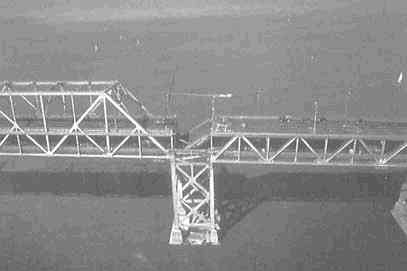
Lifeline failure—the collapse of a 50-foot section of the upper deck of the San Francisco—Oakland Bay Bridge, the only direct vehicular link between San Francisco and the East Bay. Its closure for repairs forced the cross-Bay commuters to take circuitous routes far to the north or south, or to rely on the BART rapid transit system, which was not damaged (NOAA).
natural processes and recreation. Both the land classification plan and the land use design formats emphasize the mapping of appropriate land uses and policy districts. The verbal policy plan, a third type of comprehensive plan, eschews mapped policy or end-state visions and focuses on verbal policy statements. Policy regarding mitigation of natural hazards may be one area that is addressed by a verbal policy plan. A strategic plan is often a verbal policy plan, and most land classification plans and land use design plans include a section or sections of verbal policy.
A fourth type of plan is the development management plan, a programmatic plan (unlike the other three types), which lays out a specific set of regulations, public investments and acquisitions, infrastructure extension and service area policies, and preferential taxation and pricing policies.
In actuality many local plans are hybrids, combining policies, land use maps, and management programs within a single document.
Comprehensive plans are particularly appropriate for several hazard mitigation purposes:
Identifying "critical hazard areas," as well as (1) identifying compatible land use activities for those areas; (2) identifying appropriate development and construction standards and practices for future development in such areas; and (3) identifying policies for retrofitting existing development in such areas.
Identifying areas less vulnerable to hazards, where development and redevelopment will be encouraged and supported, for example, urban growth boundaries (UGBs) and urban service districts that avoid hazardous areas.
Suggesting lifeline strategies—avoiding hazardous areas in siting community facilities and water and sewer and transportation infrastructure; and imposing hazard-resistant development standards for lifeline facilities.
Traditionally, comprehensive plans tend to be policy plans—that is, they focus on principles of action to guide whole classes of future decisions by public and private decision makers. They are meant to maintain long-term consistency in the stream of incremental community decisions toward goals. However, in recent years comprehensive plans include more programmatic elements; they take the "land use management" approach and recommend specific actions.
Comprehensive plans can incorporate mitigation planning in two ways. One way is to integrate hazard mitigation, response, and recovery
pervasively throughout all of the components of the plan, including the assessment of existing and emerging conditions, the framing of goals and general policies, the formulation of community strategies, and the evaluation of plans and implementation, as discussed above. Another approach is to include a separate chapter on hazard mitigation.
California, for example, since 1972 has required city and county plans to include a separate safety element stressing natural hazards (California Governor's Office of Planning and Research, 1990). A safety element is one of seven elements that must be included in the general plan (defined as a comprehensive, long-term plan for the physical development of the community) that every city and county must draw up. A condensed version of the guidelines for this safety element is shown in Sidebar 4-1.
Adding a separate chapter on hazard mitigation to a comprehensive plan might be regarded as something between fully integrating hazard mitigation throughout the comprehensive plan on the one hand and creating a separate hazards plan on the other hand. We hasten to point out, however, that including a separate component on hazard mitigation does not preclude also integrating mitigation policies into other sections of the plan.
The March 1996 draft of San Francisco's community safety element for its master plan provides an example of a local plan under the California approach (San Francisco Planning Department, 1996a). This plan element includes links to other elements of the master plan as well as other local plans and programs, such as the emergency operations plan and post-disaster hazard mitigation plan required by the state. The community safety element of San Francisco's general plan includes a hazards analysis section with maps that delineate hazard areas; an overall hazard mitigation goal; and six categories of objectives-policies-implementation action clusters.
The draft 1996 Comprehensive Development Master Plan for Dade County, Florida, offers a second example of a local plan that incorporates hazard mitigation under state guidelines. One purpose of the plan's coastal management element is to protect human lives and property from natural disasters, and its goals and policies build on assessments based on Hurricane Andrew's impacts, as well as recommendations from the Governor's Commission on a Sustainable South Florida. The objectives of the plan include maintaining or lowering evacuation times and increasing shelter capacity by 25 percent by the year 2000, as well as orienting county planning, regulatory, and service programs to direct future
population concentrations away from coastal high-hazard areas through both pre-disaster mitigation and post-disaster redevelopment.
Nags Head, North Carolina, provides another example of a hazards plan as an element or chapter in a comprehensive plan, in this case the city's land use plan (see Sidebar 4-2).
The Option of a Stand-Alone Plan
Another local mitigation planning option is to create a plan that is separate from the community's comprehensive land use plan. An emergency response management plan is a common example of a stand-alone hazards plan, although it rarely includes attention to mitigation. A recovery and reconstruction plan is more likely to incorporate mitigation strategies. Los Angeles, for example, updated its recovery and reconstruction plan in response to lessons learned from the January 1994
SIDEBAR 4-1California's Requirements for a Safety Element in General Comprehensive Plans California requires that the general plan of each city and county include a safety element for the protection of the community from any unreasonable risks associated with: seismically induced surface rupture, ground shaking, ground failure, tsunami, seiche, and dam failure; slope instability leading to mud slides and landslides; subsidence and other geologic hazards; flooding; and wildland and urban fires. The safety element is regarded as the primary vehicle for relating local planning for safety to city and county land use decisions. A city or county must also establish land use planning policies, standards, and designations based on the criteria set forth in the safety element. Likewise, local decisions related to zoning, subdivisions, entitlement permits, and the like should be tied to the safety element's identification of hazards and hazard abatement provisions. The safety element must also specify hazard reduction design criteria and mitigation measures such as land use regulations and conditions of project approval. The state's guidelines suggest ideas for data and analyses, including maps showing known seismic and geologic hazards, location of special studies zones, and |
Northridge earthquake (Los Angeles, City of 1994). The plan contains policies in nine functional areas and describes action implementation programs associated with each policy. Actions are grouped into three groups: pre-event, short-term post-event, and long-term post-event actions. One of the nine functional areas is "Land use/Re-Use," which is where much, though not all, of the mitigation strategy is spelled out, most of it pre-event action. The plan is comprehensive in the sense that every city agency, office, or department has a defined role in implementing the plan, even the land use policies and actions.
A clearer example of stand-alone hazard mitigation planning is provided by the state of Tennessee. Tennessee's state hazard mitigation plan requires local governments to produce simple local hazard mitigation plans in order to receive post-disaster recovery grants. The State Hazard Mitigation Officer and the state's Local Planning Assistance Office and Tennessee Economic and Community Development program have pub-
faults and historic data on seismic activity. They suggest geotechnical evaluation of the potential for displacement, ground shaking, mud slides, landslides, liquefaction, and soil compaction. The guidelines also suggest attention to vulnerability, including identification of hazardous or substandard structures that may be subject to collapse in the event of an earthquake; potential for seismically induced dam failure; potential for flooding (including historical data on frequency and intensity); risk of wildland fires and urban fires; emergency evacuation routes as they relate to known hazards; peak load water supply requirements for fire fighting; and other suggested data gathering and analyses. The state guidelines suggest goals, policies, principles, and standards, including among other things, development standards on setbacks, density, allowable land uses, and site design; requirements for geotechnical evaluations of development sites; establishment of geologic hazard abatement districts; road widths for evacuation routes; and contingency plans for post-disaster response and reconstruction. The guidelines also list state agencies that are able to provide information or assistance in preparing the safety element of the community's general plan. SOURCE: California Governor's Office of Planning and Research, 1990. |
lished planning guidelines for local governments (see Tennessee Emergency Management Agency, no date, and Tennessee Local Planning Assistance Office, no date). Sidebar 4-3 describes the Tennessee approach. Another form of stand-alone plan focuses on a particular hazard area, sometimes a small part within the jurisdiction. Thus it is less comprehensive than any of the formats discussed above and focuses on a particular community problem. An example is a floodplain management plan, which might delineate the boundaries of a floodplain regulation overlay district, indicate specific properties to be acquired, propose a levee or replacement bridge, and perhaps indicate the location of a wetland flood storage area.
It is important to point out that even the stand-alone hazard mitigation plan can include land use strategies, as evidenced by the Los Angeles and Tennessee examples, and does not imply an avoidance of land use and development strategies for hazard mitigation. Stand-alone mitigation plans also can (and should) be coordinated with comprehensive land use plans.
SIDEBAR 4-2Incorporating a Hazards Plan as a Chapter of a Comprehensive Land Use Plan (Nags Head, N.C.) In the 1990 Land Use Plan for Nags Head, North Carolina, the chapter on hurricane and coastal storm hazard mitigation is one of 20 chapters dealing with topics such as managing growth, traffic and transportation, water and sewer service, economic development, housing, and the like. However, hazard mitigation also is considered in other chapters, such as traffic and transportation, where hurricane evacuation is addressed as a critical issue. The mitigation chapter refers the reader to other planning documents, such as the 1988 Comprehensive Hurricane and Storm Mitigation and Reconstruction Plan, which provides for a reconstruction task force, a post-storm development moratorium, and other ordinances, and the Flood Insurance Rate Maps (FIRMs), which identify the various flood hazard areas. The mitigation chapter of the Nags Head plan first describes the threats to life and property posed by hurricanes and severe coastal storms, maps the location of storm hazard areas (including flood zones and areas where new inlets might be formed), and estimates the dollar amount of property at risk in each hazard zone. It then states its goal: "to reduce, to the extent possible, future damage from |
Choice Four: The Mitigation Strategy
A fourth major area of choice in developing the plan is the choice of the mitigation strategy to be employed by the community. In contrast to choices about planning process, planning components, or type of plan, this is a choice about the substance of the plan's recommendations. A particular mitigation strategy involves choices regarding six variables:
Taking a coercive approach versus a cooperative approach to influence private sector behavior
Employing one local governmental power versus another
Shaping future development versus addressing existing development at risk
Controlling the hazard versus controlling human behavior
Taking action before a disaster occurs versus taking action afterward, during recovery
Going it alone versus taking an intergovernmental and regional approach.
hurricanes and severe coastal storms . . . both in advance of such events and . . . during reconstruction" (p. 31). To achieve this goal, the plan spells out a number of policies (pp. 31-32): "Pre-Storm Mitigation.
|
Coercive versus cooperative approach
The coercive approach prescribes a required behavior, with sanctions for failure to comply. It gives the target population of developers, landowners, residents, or businesses little choice about whether and how to meet requirements. The coercive approach emphasizes regulations, and a more formal and legalistic implementation style in enforcement. The cooperative approach, sometimes called the collaborative or co-production approach, prescribes goals to be achieved but not the precise means of attaining them. To enhance adherence to policy objectives, the more coercive approaches employ more and heavier sanctions and disincentives; cooperative approaches seek to induce change by offering incentives, removing obstacles, or educating stakeholders, and taking a more flexible approach to regulations and their enforcement. [May et al. (1996) and May and Burby (1996) compare the performance of coercive and cooperative approaches to hazard mitigation.] A hazard plan might
"Post-Storm Reconstruction.
SOURCE: Nags Head, N.C., City of, 1990. |
incorporate both cooperative and coercive strategies in order to address different types of problems or different target groups.
Choosing between governmental powers
As discussed earlier in this chapter, local governments have several types of powers, including the power to plan, the police power, the power to acquire land and property, the power to invest in capital improvements, and the power to tax. Most mitigation strategies will entail the use of more than one power, but will vary according to which power or powers they emphasize, the coordination among the actual devices utilizing these powers, and even the combination of several powers within a device (e.g., incorporating eminent domain with acquisition, including an impact fee or tax as part of a regulation).
Shaping future development versus addressing existing population and property at risk
The plan may choose to focus on future development or on existing development or both, depending on the relationships between hazards and urban land use patterns. The first option implies limiting new private and public development in hazard-prone areas, requiring hazard-proofing of new development, or requiring insurance, for example. Specifically, a plan concerned with future development could: (a) change the types and densities of uses allowed in the hazard area; (b) prescribe the engineering and site-design standards required of new development in the hazard area; (c) specify building design standards to strengthen structures; (d) improve knowledge about the hazard's risk and spatial variation in risk; (e) structurally control the hazard; and (f) protect the community lifeline facilities. The second option, focusing on existing development, would imply requirements or incentives for retrofitting, or acquisition of property at risk and relocation of residents and businesses, for example.
Controlling the environmental hazard versus controlling human behavior
The plan might propose control of the hazard itself in order to reduce vulnerability of populations and property, for example, by constructing or improving levees, stabilizing slopes, building flood control
dams, or installing stormwater retention and drainage infrastructure. In contrast, the plan could direct more effort to controlling human behavior by discouraging incompatible use of hazardous areas or by allowing their use but making development less vulnerable to the hazard (e.g., by imposing elevation standards for buildings in floodplains). In some cases, both types of control may be needed.
Taking action before an event versus taking action as part of a recovery program
Pre-event mitigation is, by definition, more anticipatory and preventive, and addresses future development. Post-event mitigation, however, makes use of critical windows of opportunity to rebuild without remaking past mistakes. A good plan addresses both pre- and post-disaster mitigation.
SIDEBAR 4-3 Tennessee's Guidelines for a Local Hazard Mitigation Plan Tennessee's State Hazard Mitigation Officer and Local Planning Assistance Office have collaborated to provide local governments with guidelines for creating a local hazard mitigation plan. Consistent with FEMA's guidelines for state hazard mitigation plans, the recommended parts of the local plan include the following:
|
Going it alone versus taking an intergovernmental or regional approach
Local governments may choose to coordinate their mitigation strategies with adjacent jurisdictions or a group of jurisdictions within a larger region, or even become part of a statewide strategy. In growth management states, state government may mandate that local plans include mitigation of natural hazards and, further, that such plans exhibit vertical and horizontal consistency. Vertical consistency is a requirement that local plans be consistent with state hazard mitigation goals and policy. Horizontal consistency, sometimes called regional coordination, is a requirement that local mitigation plans be coordinated with those of neighboring governments. In several states, regional planning agencies help local governments attain horizontal consistency by providing regionwide information on hazards and mediating intergovernmental conflicts about how best to address hazards.
not. The assessment should classify activities that could be done easily, those that require a change in regulations, and those that require new authority.
Easy-to-use forms and an illustration of a very simple hypothetical hazard mitigation plan are provided in a separate publication. SOURCE: Tennessee Emergency Management Agency, and Tennessee Local Planning Assistance Office, no dates. |
ASSESSING PLAN QUALITY
Every plan brings together a series of choices designed to fit the unique needs of a particular community. Yet there are accepted principles for determining what makes a good plan. It is possible to evaluate plans of whatever type, emphasis, and strategy according to established practice criteria.
This section lists criteria to be considered in producing and evaluating hazard mitigation plans. The criteria are grouped under 12 principles, which state key concerns to be considered in preparing a plan, including clarity of purpose, citizen participation, identification of issues, specification of policies, quality of fact base, integration with other plans and policy, coordination with other community development goals, planning for multiple hazards, organization and presentation, internal consistency, monitoring, and implementation.
The principles are derived from several sources. They are taken from research on the influence of state mandates on comprehensive plans, and on the plans' effectiveness in influencing adoption of hazard mitigation measures (Berke and French, 1994; Berke et al., 1996a; Burby and Dalton, 1994; Burby and May et al., 1997; Dalton and Burby, 1994). The principles are also derived from research on how well plans are integrating the concept of sustainable development in New Zealand (Berke et al., 1996) and in 30 communities in the United States (Berke and Manta, 1997). Another source is evaluations of the effects of these principles of plan quality on mitigation measures adopted by the states under the Stafford Disaster Relief Act (Godschalk et al., 1996).
These principles are not conclusive. They should not be viewed as a checklist, with each principle corresponding to a particular compliance criterion required by state planning mandates. Rather, these principles should provide guidance, with user discretion required as to their application in particular local circumstances. They reflect basic planning concepts and are intended as a starting point, to help planners think systematically about what should be included in a good mitigation plan. Given variation in local purposes and circumstances, there may be differences in the applicability of different principles and criteria. Communities should modify the principles to fit their own needs.
Principles and Criteria for Preparing and Evaluating Mitigation Plans
Clarity of purpose: the plan should clearly identify and explain the desired mitigation outcomes.
1.1 Is there a clear articulation of desired mitigation outcomes?
1.2 Are mitigation outcomes linked to broader environmental, social, and economic outcomes?
1.3 Is there a clear discussion of how the plan can be used to effect mitigation outcomes (that is, of the connection between public interests and actions, and of methods of implementation)?
1.4 Is there a clear explanation of state and federal legislation enabling or requiring the plan?
1.5 Does the plan clearly explain how legislative provisions are to be implemented?
Citizen participation: the plan should be based on explicit procedures for involving stakeholders.
2.1 What organizations and individuals were involved in the preparation of the mitigation plan (public officials, elected officials, citizens, representatives of stakeholder groups, consultants)?
2.2 Why were they involved (e.g., selected due to expertise or because they represent a particular constituency, or self-selected volunteers)?
2.3 Are the stakeholders who were involved representative of all groups that are affected by polices and implementation actions proposed?
2.4 What participation techniques were used (e.g., citizen participation program, blue ribbon panel, advisory commission, focus groups, charettes/workshops)?
2.5 To what extent do participation techniques elicit passive stakeholder involvement (e.g., by provision of educational materials, or by citizen review of plans at public hearings) versus active involvement (e.g., through neighborhood organization efforts, or through citizen control of resources and direct public and private investment decisions)?
2.6 Is there a historical account of how stakeholder involvement in the plan is related to prior planning activities?
Issue identification: the plan should discuss and prioritize significant mitigation issues.
3.1 Are issues related to natural hazards clearly identified?
3.2 Is background information on each issue, including causes and effects, clearly explained?
3.3 Are issues prioritized?
3.4 Is the rationale for prioritizing issues clearly explained?
Policy specification: the plan should provide specific policies to guide decision making and planning.
4.1 Are mitigation policies specific enough to be tied to definite actions? (For example, a vague policy would be to reduce flood risk; a specific policy would be to reduce development densities in floodplains.)
4.2 Are mitigation policies merely suggested (with words like consider, should, may), or are they mandatory (with words like shall, will, require, mandate)?
Fact base: the plan should be built on a solid database foundation.
5.1 Are explanations of issues, current conditions, trends, and likely future conditions supported by good quality data?
5.2 Are explanations of mitigation policy proposals congruent with scientific data? With common knowledge?
5.3 Are methods and models used for deriving facts cited?
5.4 Are maps that identify hazardous areas and vulnerable structures included? Do the maps display information that is relevant and comprehensible?
5.5 Are tables that aggregate data about vulnerable structures and populations included? Are the formats of tables relevant and comprehensible?
5.6 Are sources given for background information and data?
Policy integration: the plan should coordinate its actions with those of other relevant agencies.
6.1 Are plans internal and external to the community mentioned in the plan?
6.2 How clear is the explanation of the relationship of each mentioned policy/policy instrument to the plan under study?
Linkage with community development: the plan should link mitigation and community development objectives.
7.1 Are mitigation goals tied to other publicly supported development goals (e.g., enhancing open space in recreation areas, environmental conservation, more efficient use of public infrastructure investments)?
7.2 Are the policy instruments (e.g., zoning, building codes) used for carrying out mitigation also used for other community development aims?
Multiple hazard scope: the plan should deal with all hazards affecting the community.
8.1 Does the plan include mitigation goals and policies that are generic and effective for all the various hazards a community might face?
8.2 Are hazard risk assessments conducted for multiple hazards rather than single hazards?
8.3 Are risks to life and property posed by different hazards compared and prioritized?
Organization and presentation: the plan should be understandable to a wide range of readers.
9.1 Does it include a table of contents (not just list of chapters)?
9.2 Does it include a glossary of terms and definitions?
9.3 Does it include an executive summary?
9.4 Is there cross-referencing of issues, goals, objectives, and policies?
9.5 Are clear illustrations used (e.g., diagrams, pictures)?
9.6 Is spatial information clearly illustrated on maps?
9.7 Are supporting documents included with the plan (video, CD, GIS, Web-Page)?
Internal consistency: the plan should ensure consistency among its various goals, objectives, and policies.
10.1 Are mitigation goals comprehensive enough to accommodate strategic issues?
10.2 Are mitigation policies clearly linked to certain goals?
Performance monitoring: the plan should include indicators for assessing goal achievement.
11.1 Are clearly defined outcomes stated in the plan (number of historic buildings strengthened, transportation systems that accommodate evacuation times within an acceptable number of hours)?
11.2 Are clear indicators of each outcome included? Are development and land use standards included that suggest thresholds not to be exceeded (e.g., allowable development densities in hazard zones)?
11.3 Does the plan identify organizations that are responsible for monitoring and/or providing data for indicators?
Implementation: the plan should commit the community to carry out its proposed actions.
12.1 Are timelines for implementation identified?
12.2 Does the plan clearly identify organizations that are responsible for implementation policies?
12.3 Does the data identify sources of funding for implementation?
CONCLUSIONS
This chapter reviewed the role of land use planning in mitigating the risks posed by natural hazards. We emphasized the importance of local governments in planning mitigation strategies for good land use in hazardous areas. We argued that the crucial role of land use planning in mitigation must be anchored in a community-based planning process. Although federal and state governments play a crucial role in setting ground rules for mitigation and enabling communities to deal with the complex land use problems involved, our contention is that local governments must be the driving force. We explained why they are best suited to seek mitigation solutions given their basic powers and authorities. We also discussed why local governments are best able to make critical choices about stakeholder participation processes, and about how to craft high-quality plans that are tailored to local needs and capabilities.
The goal of sustainable development underpins hazard mitigation and land use planning. Achieving a pattern of human settlement that can withstand natural hazards should be a central objective of any community land use planning program. Land use patterns that fail to acknowledge the location of high-risk areas like floodplains, steep slopes, and seismic faults are not sustainable. Housing and public infrastructure not built to resist the predictable physical forces of hazards are not sustainable. Sustainable communities minimize exposure to hazards and enhance resilience in the face of natural forces.
To be more sustainable, communities must integrate hazard reduction with other social, economic, and environmental goals. Every new development project and public investment should be evaluated with regard to several criteria for sustainability. Are ecological limits recognized in public and private land use decisions in hazardous areas? Do land use decisions for hazard mitigation accommodate prospects for enduring economic development? Do land use decisions seek an equitable distribution of risks of hazards and benefits of mitigation? How can all people participate meaningfully in formulating land use and mitigation decisions that affect them? These criteria can be added to the criteria discussed in this chapter for evaluating plans. They also represent an opportunity to increase public understanding of land use management and hazard mitigation.
Local planning practice is evolving from a focus on post-disaster recovery and redevelopment to a focus on pre-disaster mitigation linked to land use planning. Increasingly, planners are learning how to demonstrate to citizens and decision makers how much sense it makes to deal with hazards before they become disasters.