Prevention and Mitigation of Bridge and Tunnel Strikes (2025)
Chapter: Appendix K: BrTS Data Clearinghouse User Manual
About
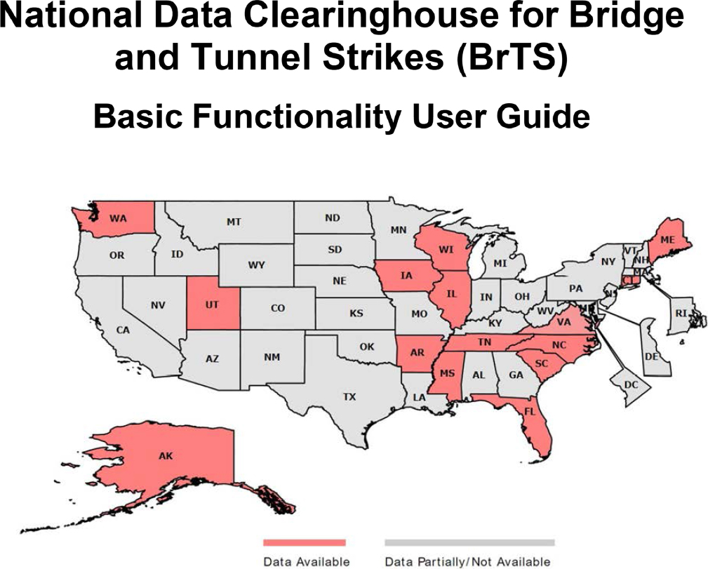
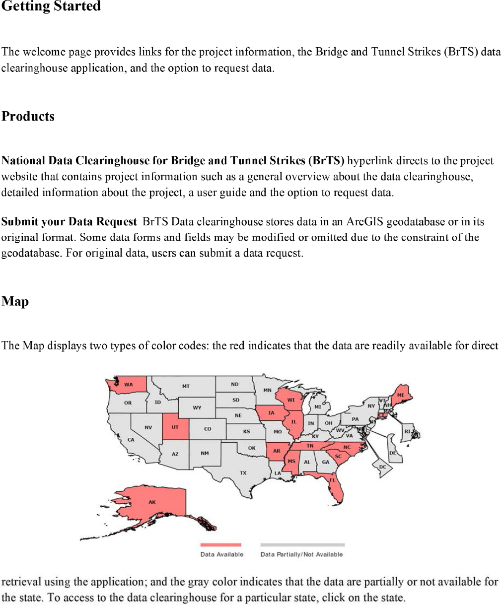
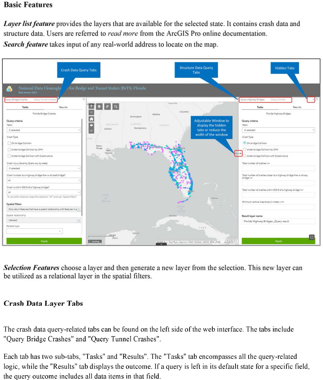
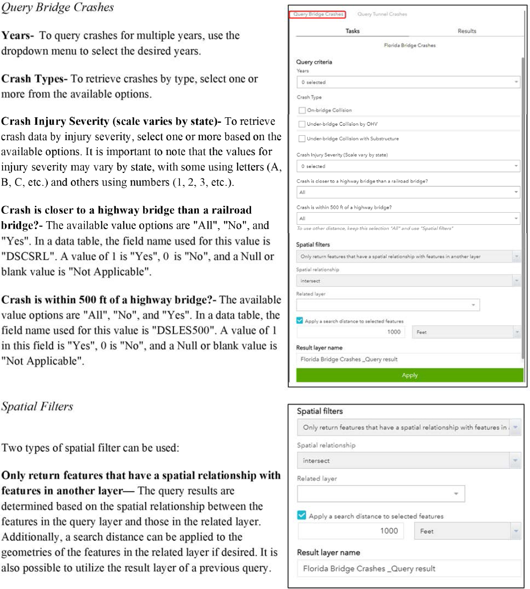
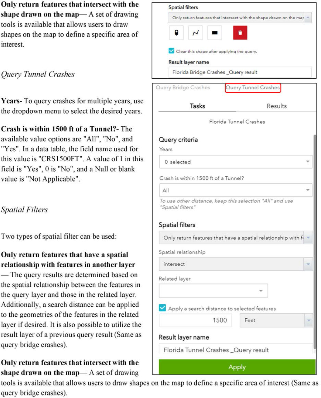
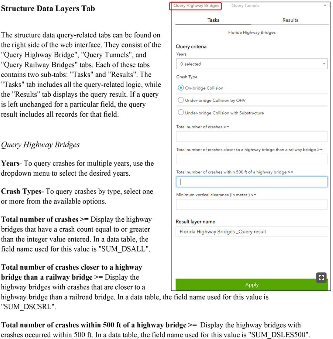
The User Guide is intended to provide an overview of the basic functions of the National Data Clearinghouse for Bridge and Tunnel Strikes (BrTS) Web Application. Developed with the ArcGIS Online Application, the data clearinghouse offers an interactive mapping interface to query and display crash and structure data, and collision risk from the participating states.
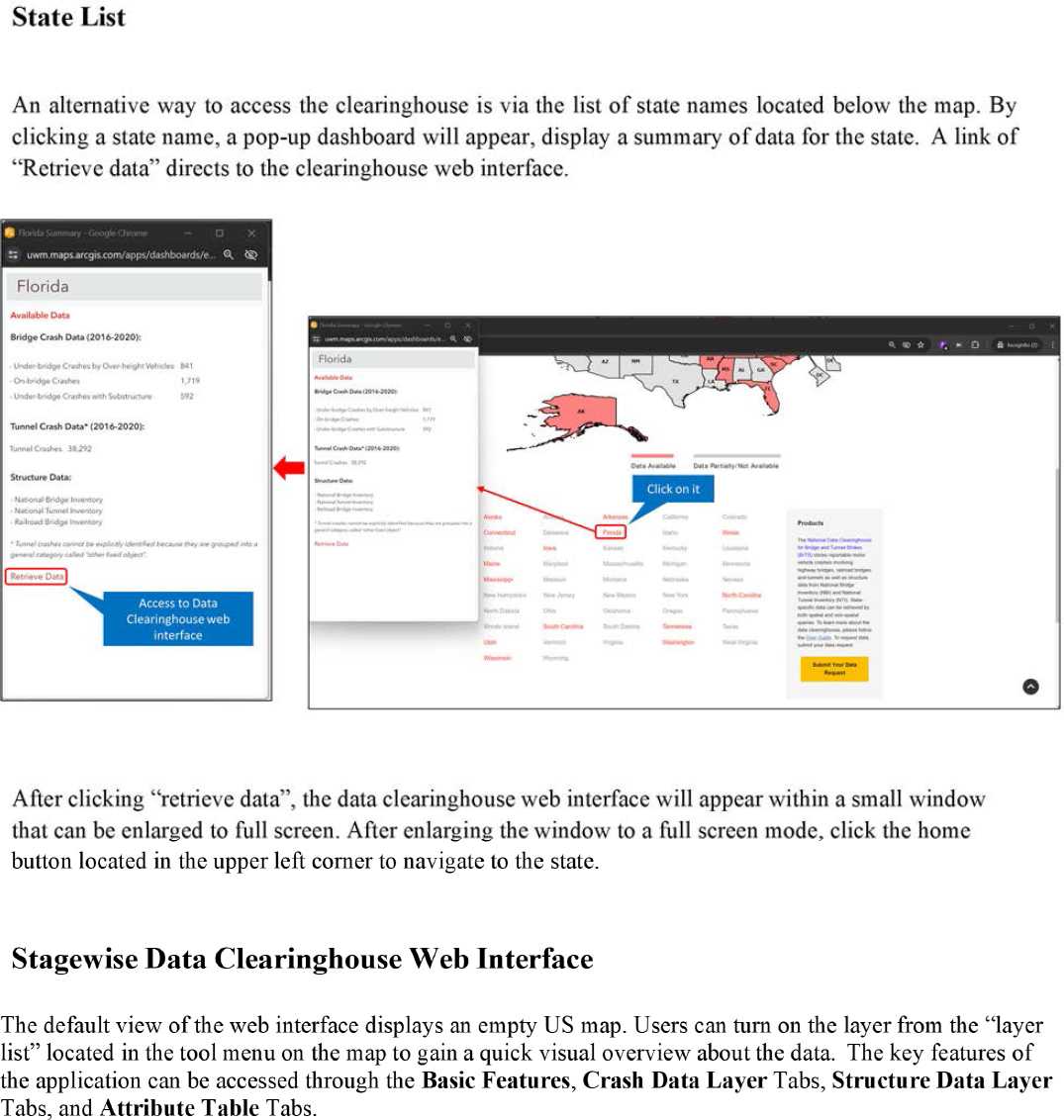
This web application aims to establish a national level data repository for collecting and analyzing bridge and tunnel strike data. It uses a data-driven method to assess the risk of a bridge or a tunnel strike by motor vehicles. This application can help state and local transportation engineers and planners to better assess, quantify and communicate the risk of bridge and tunnel-related crashes. Notably, the functionalities listed in this document are not exhaustive. The retrieved data can be exported to a comma-separated values (CSV) file, which is compatible with Microsoft Excel and ArcGIS. Users can learn how to view and query data in the “Stagewise Data Clearinghouse Web Interface” section of this Guide. To learn more about the tools used in the National Data Clearinghouse for Bridge and Tunnel Strikes (BrTS), users are encouraged to refer to ArcGIS Pro Online documentation.
FAQs
-
Upon opening the application for a state, I do not see any available queries. Why is this?
Upon opening the application for a state, if no query is visible, it is likely because the application randomly chooses tabs to display. In some cases, data for a specific tab may not be fully available for that state, resulting in an empty tab. To access to available data, please use the other tab(s).
-
I visited the application for a particular state, but after opening the application of that state, it is not showing a query for a particular tab. Any reason for that?
Sometimes, the application does not load all the data layers properly. Therefore. you need to reload or re-open the application, which will solve this problem.
-
After running several queries, I have noticed that the application is becoming slow when processing new queries. Is there a reason for this and how can I prevent it?
If the application is getting slow with new queries after generating several queries, it may be due to the generated query results being stored in memory, which can degrade the application’s performance. To avoid this issue, it is recommended not to keep adding too many query results or to delete the query result after use.
-
I have downloaded the data and noticed that there are some fields that I do not understand, as they are not defined in the raw data or in the User Guide. Where can I find information about these fields?
Data fields not defined in either the raw data or the User Guide are because they are for internal use only, and are necessary for further development of the application. Users are recommended to discard those fields.
-
Does the crash or structure data include all the data fields from the raw data?
The raw data is stored in ArcGIS geodatabase, which has a limit of 255 fields. Any fields located after the 255th field were discarded. However, it is not guaranteed that the raw data collected from state agencies contains all fields.
- I have noticed that certain field formats are different than what I am familiar with for a specific state. Can you provide an explanation for this?